Index >> Graphic Apps >> Other >> OkMap
Report SpywareOkMap 10.9.0

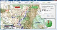 Click to enlarge screenshot
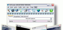
Software Description:
OkMap - GPS and map Windows software for many outdoor activities
OkMap is a GPS and map software that:
-Works with vectorial maps and calibrates raster maps
-Organizes paths by creating waypoints, routes and tracks
-Uploads/downloads data to/from your GPS
-Uses altitude DEM data
-Supports GPS real-time navigation
-Sends/receives vehicles position and display tracks on maps in real time
-Provides autorouting and geocoding functions
-Supports integration with Google Maps/Earth (in 3D also)
Potential use:
-Search and rescue
-Trekking
-Off road
-Boating
-Flying
-Mountain bike
-Geocaching
-Hunting and fishing
-Finding mushrooms
-Soft air
Main features:
-Calibrate raster maps with different cartographic projections
-Create own digital maps importing / drawing shapes
-Create and manage waypoints, routes and tracks in GPX format
-Download, save and automatically georeference maps from Google Maps
-Support autorouting, geocoding and inverse geocoding functions
-Use digital terrain models to store and display elevation
-Upload / download data to / from GPS devices
-Navigate in real time through NMEA protocol
-Map tiling for handheld GPS
-Display Google Earth and Google Maps in current map location
-Exchange data with Google Earth and view your map in 3D
-Find nearby cache in www.geocaching.com
-Exchange data with gpsgate.com server
-Receive navigation data from remote GPS devices
-Send the current position to an OkMap remote server
-Make conversions between coordinates, datums, formats, ...
Supported formats:
-Images: ECW, BMP, GIF, JPG, PNG, TIF and many others
-Maps: World file; ECW; GeoTiff; KML/KMZ; OziExplorer; CompeGps; GPS TrackMaker; GpsTuner
-Map Tiling: KML, KMZ, JNX, OruxMaps and OkMap
-Vectorial data: SHP, DBF (Esri shape file); DCW (Digital Chart of World)
-GPS data: GPX (GPS Exchange Format); CompeGPS, EasyGPS, Fugawi, Garmin, Geocaching LOC, Google Earth (kml/kmz), GPS TrackMaker, Open StreetMap, OziExplorer and others
-DEM data (digital earth model): HGT (SRTM-1 e SRTM-3)
Feature List:
- Calibrate vectorial and raster maps with diffent types of cartographic projections
- Create own digital maps drawing point, multipoint, polyline and polygon vector
- Display simultaneously raster maps and vectorial data
- Import digital vectorial data based on different types of cartographic projections
- Use calibrated maps and vectorial data as background for navigation
- Create and represent on maps (raster and vectorial): waypoints, routes and tracks
- Use digital terrain models to display the elevation of any point on the map
- Load and save waypoints, routes and tracks in GPX format
- Upload and download waypoints, routes and tracks to and from a GPS device
- Navigate in real time via a GPS device through NMEA protocol
- Display Google Earth and Google Maps in current map location
- Exchange data with Google Earth
- Exchange data with gpsgate.com server
- Receive via socket customized navigation data from remote GPS devices
- Send via socket the current position to an OkMap remote server
- Make conversions between different types of coordinates, datums, formats, etc.
- Use a handy calculator for your calculations
100% Clean:
 OkMap 10.9.0 is 100% clean
This download (okmap.zip) was tested thoroughly and was found 100% clean. Click "Report Spyware" link on the top if you found this software contains any form of malware, including but not limited to: spyware, viruses, trojans and backdoors.
Related Software:
- TiffCombine 1.5 - Combine TIFF files easily
- CD & DVD Box Labeler Pro 2016 1.9.97r2 - Design your own custom CD, DVD & Blu-Ray Labels with this easy to use software.
- Ashampoo Photo Mailer 1.0.8 - Ashampoo Photo Mailer - the easiest way to share photos through email.
- Media Resizer FREE thumbnail creator 2.57 - Creating image thumbnails has never been easier!
- Pocket Wallpaper 1.01 - Create themes and wallpaper for PocketPC and other mobile devices.
- Kaleider 4.9.2 - Kaleider emulates kaleidoscope, mirroring, 3D mirroring and funneling effects.
- Photo to PSP 1.10 - Easy transfer and resize of photos to PlayStation Portable, PSP
- ColorMania 5.0 - Color Picker with Eyedropper and Screen Magnifier
- ConceptDraw for Mac 7.6 - Discover the world of visual communication
- ConceptDraw 7.5 - Discover the world of visual communication
top 10 most downloaded
recommended software
-
- 1AVCenter
- With 1AVCenter you can record your entire screen or part of it directly to AVI or WMV, capture screenshots in JPG, share your screen over the internet...
-
- IconEdit2
- Create and edit icon files for Windows, iPhone, iPad, Apple Watch, and Android with professional yet easy-to-use Icon Editor. IconEdit2 has full suppo...