Index >> Business >> Math & Scientific Tools >> Eye4Software Hydromagic
Report SpywareEye4Software Hydromagic 7.0.15.929
Software Description:
Eye4Software Hydromagic - Hydrographic Survey Software for Windows, Single Beam Data Collection
Eye4Software Hydromagic is hydrographic survey software for Windows. It can be used to generare depth maps using a GPS or RTK receiver and an echosounder or fishfinder.
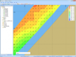
After recording the sounding, you can generate DTM's (Digital Terrain Models), depth contours, 3D views and cross-sections.
It offers various methods of calculating volumes of bassins, ponds, river sections and lakes.
The software is capable of reading and writing most popular CAD, GIS and nautical chart formats, including: GeoTIFF, Microstation DGN, ARC/INFO, MapInfo MIF/MID, AutoCad DXF files, IHO S57/S63 Electronic Natutical Charts, Google Earth KML/KMZ files and ESRI shapefiles.
A wide range of map projections is build in. More then 5000 map projections are built in. In addition, NTv2, NADCON and HARN correction grids are supported.
The software is also able to calculate tide levels in real time by using a RTK receiver connected to the PC. Using the antenna height, antenna offset and a geoid model, the tide level is calculated and applied to the sounding, resulting in a height values relative to the local vertical datum.
When no map is available for your area, you can use the build-in map downloading tool. Use OpenStreetMap, Google Maps or Bing maps as background maps.
Since this latest version, the software can be used to collect and process dual frequency sounding data, as well as additional sensor data, such as magnetometer data, or advanced data from echosounders, like reflectivity or bottom-loss.
Another big improvement is the use of shorelines. Shorelines can be used to add data collected near the shore, to create islands or to clip your DTM data, by just by specifying on which side of the shoreline the water is.
For the people who want to perform their survey by using planned lines, there is also good news: It is now possible to calculate a DTM or depth contours from multiple soundings or shorelines. Just press a single key to start a new line !
What's New: Improved data collection module, support for latency, added device plugins for motions sensors and total stations.
Limitations: Exporting and printing functions disabled in demo version
Feature List:
- The software can communicate with almost any GPS device to retrieve your current position and show it on one of the supported raster or vectormaps. Any GPS device supporting the NMEA0183 protocol is supportd. It is possible to record your movements and the measured depths to a track
- When a map is loaded, you can also calculate distance and course, add symbols, lines, boundaries and comments to your map and save and / or print them
- GeoTIFF
- IHO-S57 Electronic Nautical Charts (ENCs)
- AutoCad DXF CAD files
- Microstation ISFF DGN files
- MapInfo MIF/MID files
- Arc/Info Export files
- OpenStreetMap XML files, and OpenStreetMap PNG tiles through calibration
- ESRI Shapefiles
- BSB nautical charts
- JPG files, through user calibration or JGW (JPEG World File)
- TIF files, through user calibration or TFW (TIFF World File)
- GIF Files, through user calibration or GFW (GIF World File)
- PNG Files, through user calibration or PGW (PNG World File)
- BMP Files, through user calibration or BPW (BMP World File)
- Overlay data, such as comments, waypoints, matrix and track data can be imported from or exported to different file formats. File formats supported include ASCII XYZ Files, Topographix GPX GPS Exchange Files, Garmin Database, Maptech and OziExplorer PLT, WPT and RTE Files. You can export both manually added data as well as all data stored on your GPS device
- To display a part of the globe (ellips or sphere) on a display(plane), a map projection is needed to prevent distortion of the map data. The software is shipped with a database containing over 3500 predefined map projections. You can also delete, modify and add new definitions
- Transverse Mercator
- Oblique Mercator
- Mercator
- Oblique Stereographic
- Polar Stereographic
- Albers Equal Area Conic
- Lambert Conformal Conic
- Lambert Azimuthal Equal Area
- Krovak
- Eckert IV
- Eckert VI
- Mollweide
- Cassini
- Polyconic
- Miller
- Bonne
- Sinusoidal
- Cylindrical Equal Area
- Built in track editor to edit or correct your soundings
- Generate depth contours
- Generate regularly spaced XYZ data
- Show cross-sections
- Calculate volumes
- Skyview
- Map calibration, to use your own downloaded or scanned GIF, PNG, BMP, JPG and TIF maps
- Attribute viewer for GIS files like ESRI shapefiles and ENCs
- Dataview to display all information retrieved from the GPS device
- Track recorder to save all movements and measured depths to a GPS track
- Great circle calculations to perform distance and bearing calculations from point to point
- Display your position on the map realtime
100% Clean:
 Eye4Software Hydromagic 7.0.15.929 is 100% clean
This download (setup_hydromagic_demo_32bit.exe) was tested thoroughly and was found 100% clean. Click "Report Spyware" link on the top if you found this software contains any form of malware, including but not limited to: spyware, viruses, trojans and backdoors.
Related Software:
- ESBStats - Statistical Analysis Software 2.2.0 - Easy to use Statistical Analysis and Inference for Windows
- Regression Analysis and Forecasting 3.0 - Producing statistically sound value driver identification for forecasting data.
- Loan Tracker Software 5 - Amortization, Loan Tracker Software
- Function Grapher For Academic 3.9.1 - Graph maker to create 2d, 2.5d, 3D and 4d function graphs and animations.
- Energy Lens - Energy Management Software 1.6 - Helps businesses to save energy by discovering waste and improving efficiency.
- SpectrumSolvers 5.12.5 - Find best Spectral Estimation Method for a Power Spectral Density plot.
- FC-Win 5.00 - FC-Win (tm) is a front-end program for Fortran Calculus (tm)...Great Math Tool!
- Kool Swimming Pool Tool 1.0 - A cool tool to have before you plan a Swimming Pool
- Math Studio For Academic 2.8.1 - Math tool for school math teaching and studying.
- EasyFit 5.0 - Analyze your probability data and apply the results to make business decisions.
top 10 most downloaded
recommended software
-
- A VIP Organizer
- VIP Organizer is a time and task management software which uses To Do List method to help you get through more work spending less time. It increases y...

-
- Salon Calendar
- Salon Calendar is a software tool designed specially for hair salons, beauty, manicure or aesthetic shops, tanning salons, fitness studios, wedding sa...


